Cartography
Maps I have produced for Clients as well as personal projects
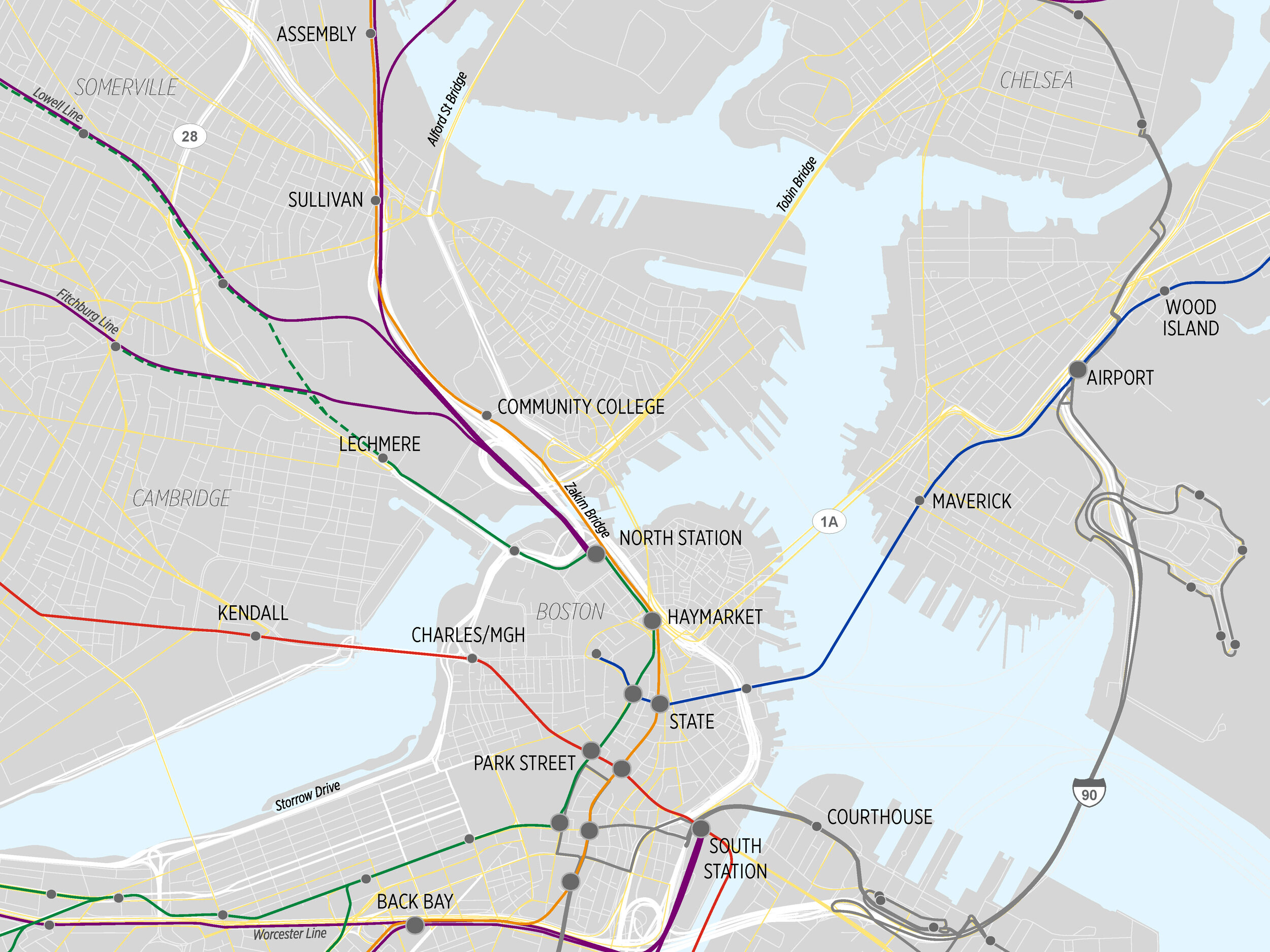
Map of Greater Boston from a project proposal, Spring 2020
Urban CamTran routes in Johnstown, Pennsylvania region, Spring 2020
Travel Flows in Greater Johnstown, PA, Spring 2020
Adjusted Composite Density for Johnstown, PA, Spring 2020
Adjusted Population Density for Johnstown, PA, Spring 2020
Rural CamTran+ Routes in Cambria County, PA (Spring 2020)
Transit Index Factors (TIF) map for Cambria County, PA, Spring 2020
Greater Boston MBTA Station Area Walkability Scores, Spring 2020
Greater Boston MBTA Station Area Bikeability Scores and Bikesheds, Spring 2020
MBTA Commuter Rail Parking Utilization and Inventory, Winter 2020
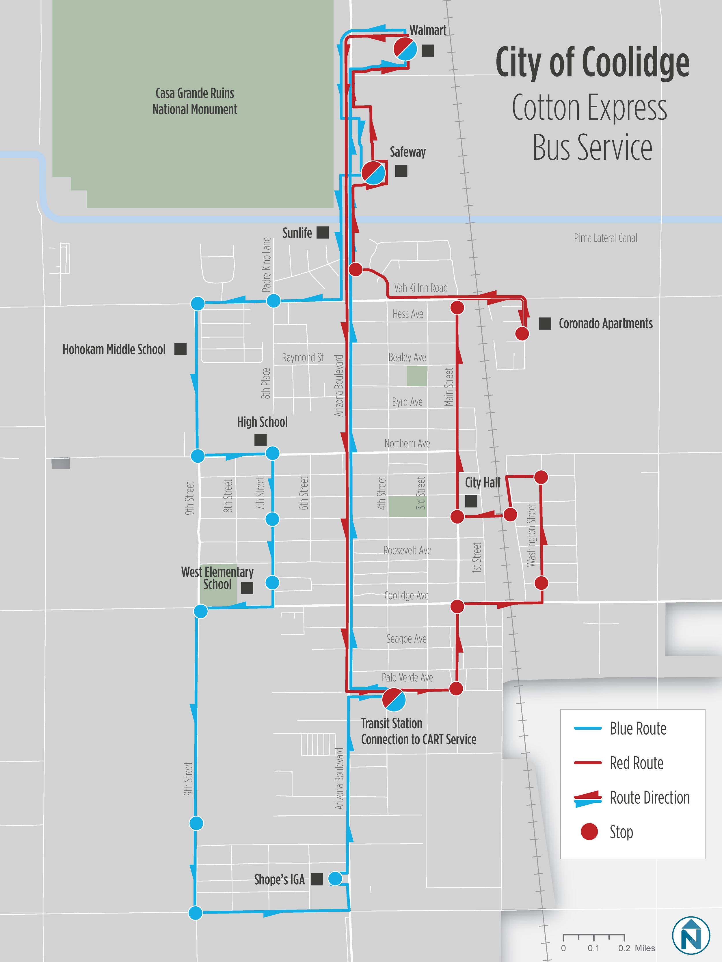
Cotton Express Bus Service in Coolidge, AZ, Fall 2019
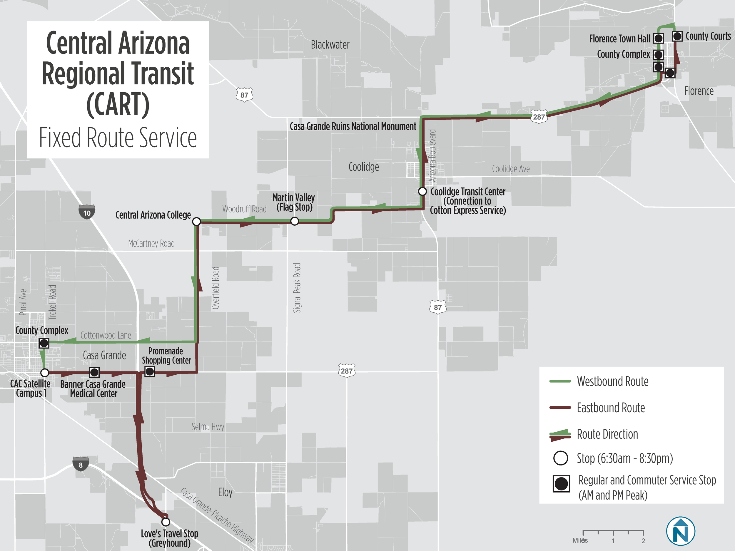
CART Fixed-Route Service in Pinal County, AZ, Fall 2019
Activity Centers in Pinal County, AZ, Fall 2019
Cities where Pinal County residents work, Fall 2019
Bus-On-Shoulder Service operated by Pace Bus in the Chicagoland Area, Fall 2019
Bus Service in the Greater Joliet, IL Region, Fall 2019
Major Job Centers in the Chicagoland Area, Fall 2019
National Highway System map for Connecticut DOT
Map of a fictional transit system for a case study produced for the Transportation Research Board (TRB)'s Transit Cooperative Research Program (TCRP)
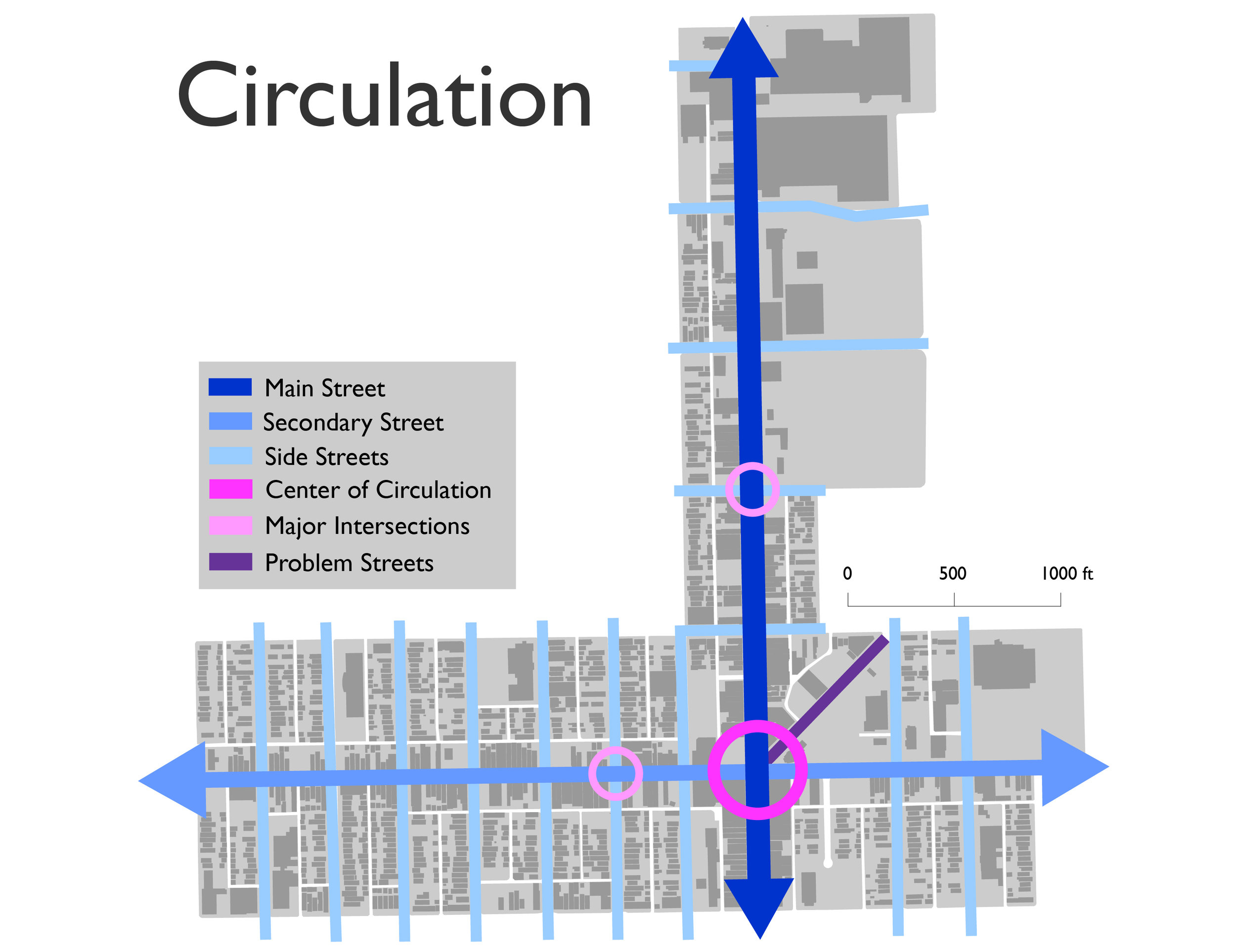
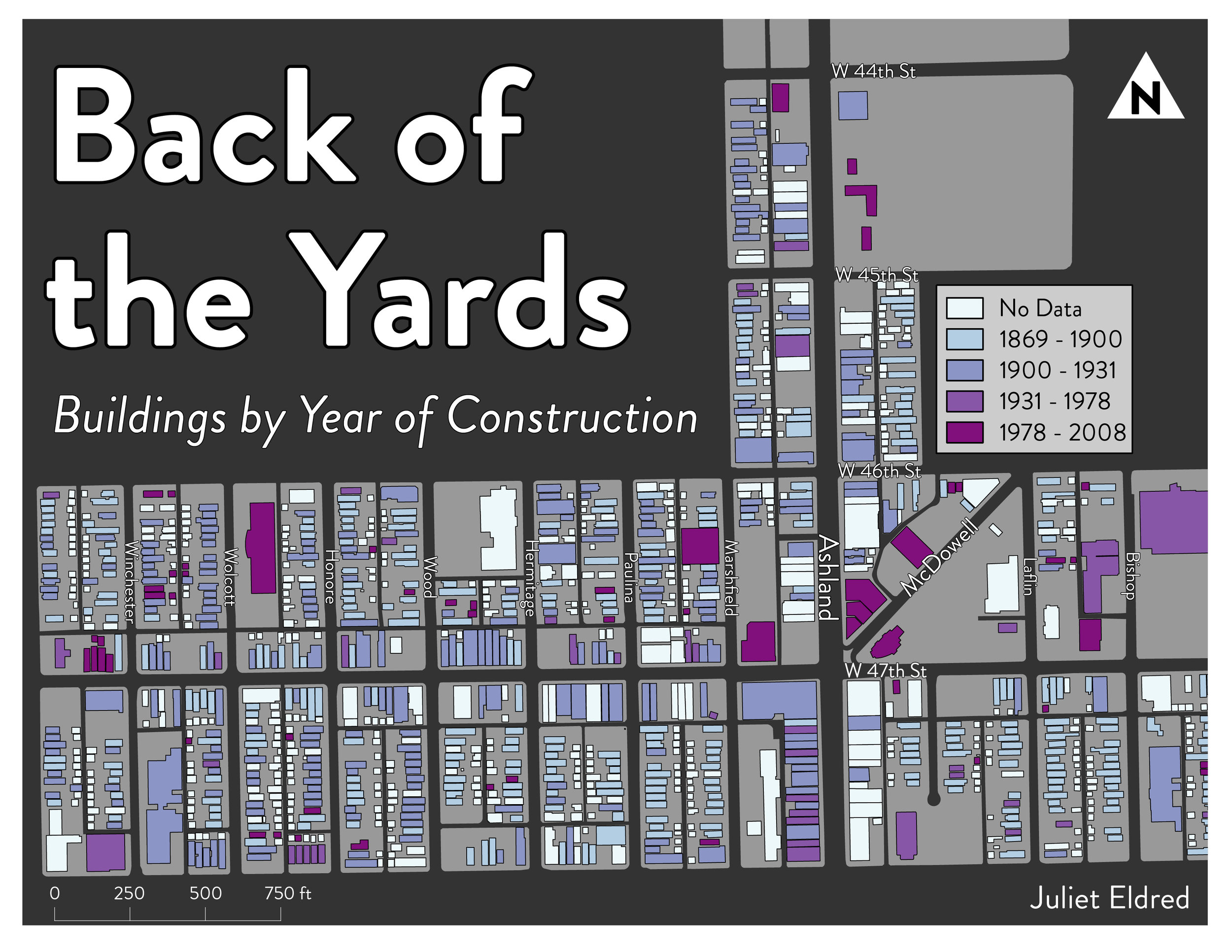
Visuals from Urban Design Studio presentation on proposed design interventions in Back of the Yards, Spring 2017
Map of University of Chicago properties and parking lots along 61st street for Geography BA Thesis, Spring 2017
Points of Interest, a vaguely speculative narrative map based on a heatmap of my actual location history data, February 2017
Diagram of Buckingham Fountain for Chicago Urban Design, Fall 2016
Map diagram of Kenwood Avenue between 60th and 61st Streets for Chicago Urban Design class assignment, November 2016
Where Google Maps Told Me I Was
Ongoing digital mapping project, created using my Google Location History data, exported into QGIS then Adobe Illustrator
Partial map of Washington, DC for the conference table of Dr. Chris Gerdes, Chief Innovation Officer, US Department of Transportation
Where Google Maps Told Me I Went, 6/10-6/16